Source than sink: Southeastern Amazonia emits more carbon dioxide than it absorbs

View of deforested areas at southeast Amazon region (Alta Floresta, Mato Grosso state, Brazil) from the aircraft windown. Source: Luciana Gatti

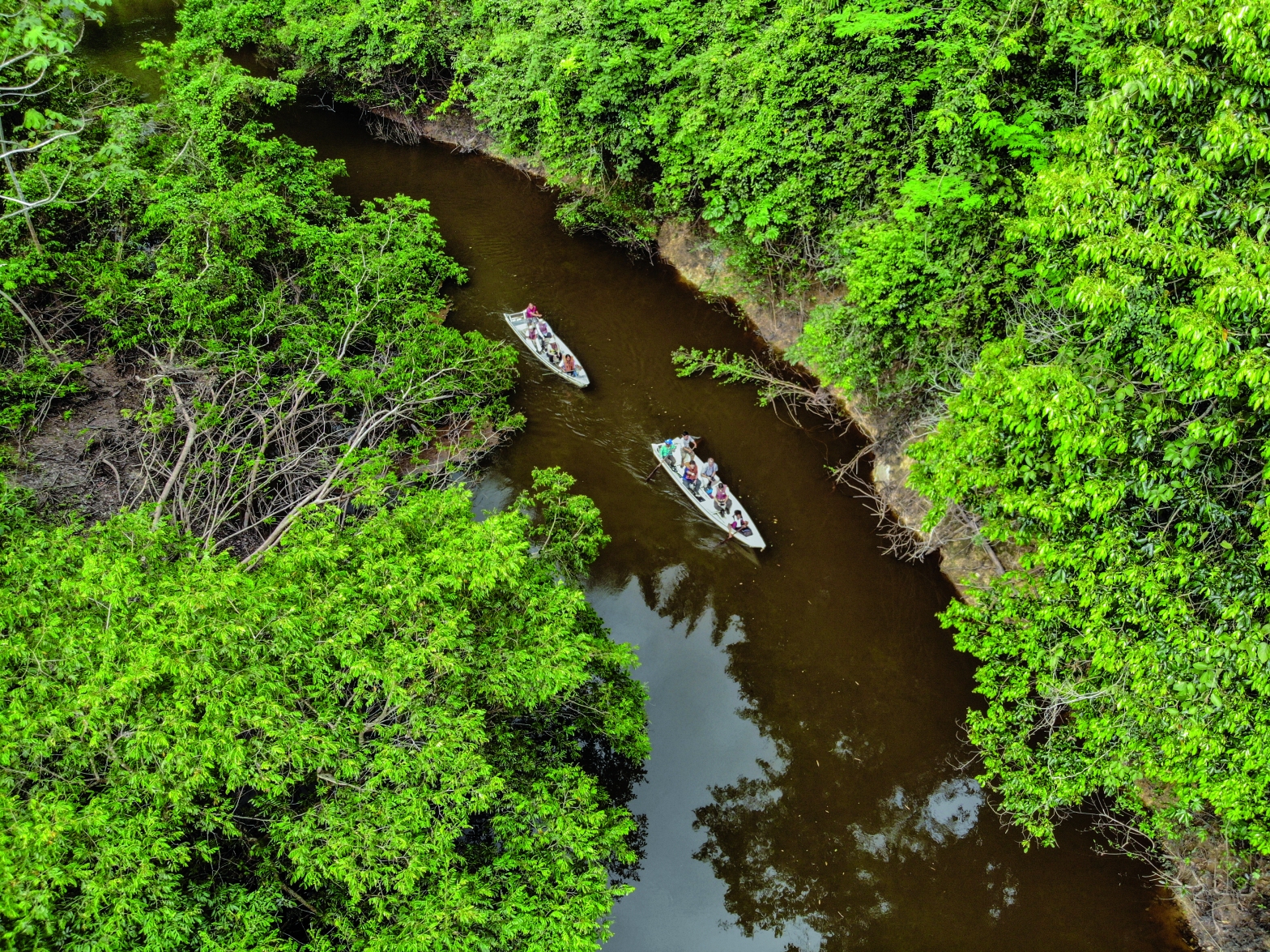
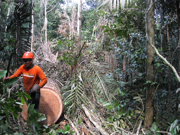
The Amazon, the largest tropical forest in the world, has played a vital role in absorbing carbon dioxide from the atmosphere and helping offset some global warming. Within the several last decades, deforestation and global warming have affected precipitation and temperature, which could significantly impact the Amazon’s ability to uptake carbon. Forest loss within the region accounts for 17% of the total area, with most of the area being converted to agricultural lands. Previous studies showed that in the last few years a decline in carbon uptake by trees in the Amazon occurred (Briennen et al., 2015), with an increase in tree mortality (Muelbert-Esquievel, et al., 2020).

Our recent study published in Nature (Gatti et al., 2021), showed that carbon dioxide (CO2) fluxes between 2010 and 2018 greatly declined in some regions of the Amazon using 590 aircraft vertical profiling measurements of lower-tropospheric concentrations of carbon dioxide and carbon monoxide at four sites in Amazonia (the northwest, northeast, southwest and southeast). These vertical profiles extend from near the surface to approximately 4.5 km above sea level and are collectively sensitive to surface fluxes from a large fraction of Amazonia. CO is used to determine the fraction of the total flux (resultant of all natural and anthropogenic process) derived from biomass burning emissions. Then, removing biomass burning emissions from total emissions we obtained the net biome exchange.

Aircraft vertical profiles sampling details: a) Twin-engine aircraft used at southwest site, showing in detail the inlet in the inspection window, temperature and relative humidity sensor and the PCP (Portable Compressor Package) and PFP (Portable Flask Package) installed in the aircraft; and b) the singleengine aircraft used at southeast site, where the inlet and temperature and relative humidity sensor are installed in the wing, and the PCP and PFP are behind the pilot’s seat. Source: Gatti et al., 2021.

Combining fluxes from all the four sites to calculate a total Amazonia carbon balance for nine years, we found a total emission of 0.29 ± 0.40 Pg C yr−1, where fire emissions represent 0.41 ± 0.05 Pg C yr−1, with a net biome exchange removing 31% of fire emissions from the atmosphere. Here, notable differences were found in carbon emissions. The east Amazon region, which represents 24% of Amazonia (and where 27% has been deforested), is responsible for 72% of total Amazonian carbon emissions, with 62% of emissions stemming from fires.

Average regions of influence (2010–2018; blue lines) of each aircraft vertical profile site (black circles), inside the Amazon mask (purple line; area of 7.25 × 10⁶ km2): TAB_TEF (northwest; TAB, 2010–2012 and TEF, 2013–2018), SAN (northeast), ALF (southeast) and RBA (southwest). Cumulative historical deforestation (red) data are from PRODES only for the Brazilian Amazon up to 2018. Source: Gatti et al., 2021.

As for the carbon emissions, we found that eastern and western Amazonia sites differ substantially with regard to human impact, in particular deforestation, and also with regard to long-term climate trends, with considerable regional contrasts in temperature and precipitation trends, mainly in the dry season. Over the last 40 years (1979-2018) the east Amazon has higher warming rates and reduction in precipitation, mainly during the dry season, than west Amazon. This was particularly pronounced in the Southeast region during the dry season with an increase in the mean temperature of 2.54º C and precipitation decreasing by 24%, suggesting an increasing in plant stress. Furthermore, a net carbon emission was observed during the nine-years in this region, suggesting that temperature and water availability in the soil significantly impact the vegetation carbon balance, at least in the southeast Amazon.

Summary of historical trends and fluxes for the regions upwind of each site: historical deforestation (orange arrows), reduction in precipitation during August to October (ASO; light blue arrows), increase in temperature during August to October (ASO; white arrows) and carbon fluxes (total fluxes, dark blue bars; NBE fluxes, green bars; and fire fluxes, red bars). Source: Gatti et al., 2021.

These results help us to better understand the long-term impacts of interactions between climate and human disturbances on the Amazonian carbon balance.  Given the current uncertainties regarding the future of tropical forests’ capacity to absorb large amounts of carbon, we must consider what could happen to central and western Amazonian regions if human disturbances continue. Additionally, the decline in the carbon uptake capacity is a strong case for ensuring we reduce even more fossil-fuel emissions if  we want to limit the global mean temperature to 1.5º C as proposed by the Paris Agreement.

About the Author: Dr. Luana S. Basso is a biologist and Visiting Research Fellow at University of Leeds, United Kingdom, as part of her Postdoctoral Research Fellow at National Institute for Space Research (INPE), Brazil. She holds a PhD and Master degree in Science at Universidade de São Paulo. She has over ten years of experience in tropical forest carbon balance, focused on understanding the role of the Amazon in the emission/absorption of Greenhouse Gases (mainly methane and carbon dioxide) and the impacts of climate change and anthropogenic activities on these balances. Twitter: @LuanaBasso16. ResearchGate: Luana-Basso E-mail: luanabasso@gmail.com.

References:

Brienen, R., Phillips, O., Feldpausch, T. et al. Long-term decline of the Amazon carbon sink. Nature 519, 344–348 (2015). https://doi.org/10.1038/nature14283

Esquivel-Muelbert, A., Phillips, O.L., Brienen, R.J.W. et al. Tree mode of death and mortality risk factors across Amazon forests. Nat Commun 11, 5515 (2020). https://doi.org/10.1038/s41467-020-18996-3

Gatti, L.V., Basso, L.S., Miller, J.B. et al. Amazonia as a carbon source linked to deforestation and climate change. Nature 595, 388–393 (2021). https://doi.org/10.1038/s41586-021-03629-6

The invisible effects of wildfires in Amazonian forests

Wildfires in humid tropical forests are one of the most critical environment problems of this century, that could define the future of the tropical forest biome and the world’s climate. In Amazonia, the largest tropical forest in the world, forests are being burned at an unprecedented rate. During the 2015/2016 El Nino, an extreme drought event, nearly 10 thousand km2 of forests were burned in the Brazilian Amazon basin (Silva Jr. et al 2019) – approximately half the size of Wales. Although the frequency of wildfires is increasing in Amazonia, we still don’t know much about them such as how the canopy of intact forests responds to the increases of fire and how much greenhouse gases emissions are emitted as a result. In the last 6 years, I have been investigating how Amazonian forests are changing after they burn and what are the consequences of these changes to forest carbon balance.

Continue reading “The invisible effects of wildfires in Amazonian forests”

Nature-based Climate Solutions must be guided by a Rights-based Approach

Within the last 50 years, the human population has doubled, with global economic demands for energy and materials increasing 4-folds. In tandem to this growth has been an increase in global temperature of 0.2 degree C per decade since 1970, and according to the IPBES 2019 Global Assessment Report, an acceleration of species extinction rate tens to hundreds times worse than the average rate over the last 10 million years. These two unprecedented environmental crises of climate change and biodiversity loss are intrinsically interlinked, as are their solutions.

Continue reading “Nature-based Climate Solutions must be guided by a Rights-based Approach”

Droughts have a significant & long-lasting change on tree and liana regeneration in a monodominant Amazon forest

Monodominant tropical forests, especially those not associated with flooded environments, are rare and still poorly understood. In the transition between Cerrado and the Amazon rainforest biomes in Brazil, lies patches of monodominant forests of “Pau-Brasil” or Bloodwood cacique (Brosimum rubescens, Figure 1). The structure of these forests have trees of different sizes and represents about 80% of above-ground biomass (Marimon et al., 2001).

Continue reading “Droughts have a significant & long-lasting change on tree and liana regeneration in a monodominant Amazon forest”

Different logging schemes impact forest management in the Brazilian Amazon

Loud, gigantic, and scary! This was my first impression of a skidder – a heavy vehicle used in cutting trees. Multiple trees are crushed to access one large Amazonian log. This was the logging operations that occurred in the Jamari National Forest in the Rondônia State of Brazil. Logging tropical trees is simultaneously an art and a damaging activity, given that these trees play a crucial role in regulating Earth’s climate. Despite this importance, only a few operations follow certified sustainable forest management plans (SFMPs).

Continue reading “Different logging schemes impact forest management in the Brazilian Amazon”

Gold mining leaves deforested Amazon land barren for years

Travel through the rainforest in Guyana, in northern South America, and you’ll often hear the indigenous adage: “a forest has no end and no beginning” to explain their natural cycle of disturbance and recovery. For the people who live in these forests, their experiences are based on decades of slash and burn cultivation, from which forests are generally able to recover well. But does the adage hold true for forests abandoned after more intense land uses?

Continue reading “Gold mining leaves deforested Amazon land barren for years”

Amplifying Global South Voices: Reflection & Actions

Since March 11 2020, our world has been disrupted by the COVID-19 pandemic and the existing and persistent inequalities of our systems are being painfully exposed. These inequalities also brought to the forefront the issue of systemic racism of people of colour and the power imbalances between Western societies and the Global South. As Amruta Byatnal, an Associate Editor at Devex mentions in her article on health and COVID-19, “Who controls the levers of development? It’s really people in the so-called global north. While global domination and structural inequality is inbuilt as constituted by economic power, it is reinforced and justified by racial power” 

Continue reading Amplifying Global South Voices: Reflection & Actions

Where the Maya People Live: Land Management in Yucatán, Mexico

The Maya solar of Yucatán, in southeast Mexico, has historically supported an intricate indigenous system of land, livelihoods and identities. It remains the basic habitat unit in the region as a vital space for the continuous development of everyday activities (social, economic, cultural, and environmental). These everyday activities contribute towards the cohesion of the family unit and the community through preservation, enrichment and diffusion of knowledge shaping individual and social identities, allowing for the survival of their way of life. Moreover, it is in this place where people organise their self-provision in a series of spaces (e.g. kitchen, barn, and henhouse) connecting their livelihoods to the surrounding land. The solar has been produced and shaped in relation to the region’s specific environmental conditions.

Continue reading “Where the Maya People Live: Land Management in Yucatán, Mexico”

Rethinking trees in a multi-cultural urban area

This article was researched and written in early 2019. A shorter version was published in September 2019 in Mongabay, who originally commissioned the piece. 

“Cherry, mango, star apple, pam, cashew, pomegranate,” Carol Dabie, 37, rattles off a list of trees that once filled her family’s yard. She recalls climbing them as a child, impatiently waiting for the small, round, sweet pam fruits with their shiny black skin to drop.

As in many backyards across Georgetown – Guyana’s expanding coastal capital – Dabie’s childhood trees were eventually cut down and the fertile earth entombed beneath concrete. It’s a shift reflected in the city’s architecture too, with breezy wooden structures slowly being replaced by low-maintenance concrete blocks.

Continue reading “Rethinking trees in a multi-cultural urban area”

Monitoring the loss of trees in the Amazon forests: How satellites, lasers, cloud computing, and artificial intelligence are helping in the fight against deforestation and degradation

Within the last few decades, forest loss in the Amazon forests has been monitored using satellites such as Landsat (30m resolution) and MODIS Terra and Aqua (250-1000m resolution). Detecting deforestation is relatively easy due to the abrupt changes in the landscape, from vegetation/forest to exposed soil or pasture. This shift causes large changes in the spectral signal (different types of surfaces reflect radiation differently, like its own fingerprint, and is a function of wavelength) measured by the satellite sensors, especially in the near infrared wavelength. The difficulty stands on reliably and systematically assessing the whole Amazon forests (>5.5 million km²) every year in order to guide public policies and action. In this sense, Brazil is a reference for deforestation monitoring through the PRODES program of INPE – the Brazilian National Institute for Space Research (Figure 1). PRODES, allied with another system that produces real-time deforestation alerts (DETER), are the core of the Brazilian efforts on reducing deforestation, with great success during the past decade.

Continue reading “Monitoring the loss of trees in the Amazon forests: How satellites, lasers, cloud computing, and artificial intelligence are helping in the fight against deforestation and degradation”

Design a site like this with WordPress.com
Get started